- Project Leader : Funabiki Ayako (College of Humanities and Sciences, Nihon University)
- Collaborators : Yanagisawa Masayuki (Center of Integrated Area Studies, Kyoto University)
- : Yonezawa Go (Graduate School for Creative Cities, Osaka City University)
- : Ota Shoichi (Center for Cultural Heritage, Kyoto Institute of Technology)
- : Shibayama Mamoru (Center for Southeast Asian Studies, Kyoto University)
- : Sakurai Yumio (The University of Tokyo, Professor Emeritus)
- : Takemura Takato (College of Humanities and Sciences, Nihon University)
Outline of Research
This project aims to clarify the impact of long-term environmental changes, such as flood events and channel evolution on the settlements located on the Song Hong (Red River) Delta, northern Vietnam. Using paleo-topographic maps, radiocarbon dating and sediment environment analysis of new drilling cores from Duong River basin, we will clarify the flood frequency in recorded history. Then, comparing them with settlement locations from historical records, we will examine how the people adapted to long-term environmental change.
Description
Massive disasters that occur only once every 1,000 years like the Great East Japan Earthquake, are hard to predict. From a geomorphologic viewpoint, it is important to investigate past tsunami, storm surges, or flood sediments to estimate the scale and period of the disasters in order to predict future disasters.
The Song Hong Delta, northern Vietnam is vulnerable to river flooding. Dynasties tried to control floods by repeatedly constructing artificial dykes. Near Hanoi City, two distributaries, named Day River and Duong River, diverge from Song Hong. These two distributaries played important roles in transport and physical distribution. Although the Day river was cut from the main Song Hong by a movable dam during the French colonial era, the Duong River flows through 20% of the whole Song Hong discharge. The Duong River is known as a fast-flowing river, and also called the “Canal des Rapides”. Because of high sediment discharge, the Duong River was once obstructed at the divergence point with the main Song Hong in 19th century.
In previous studies, no high-resolution borehole investigation has been carried out in the Duong River basin. The timing of its diversion from the main Song Hong, characteristic of the sediments and flood frequency were poorly studied. In this project, using paleotopographic maps, radiocarbon dating and environmental analysis of the new drilling core, we will investigate the flood frequency and calculate the sediment discharge caused by flooding. Then, we examine the spatial composition of villages in the historical documents and archeological records, to clarify how the people adapted to the environmental changes on a millennium and centennial time scale.
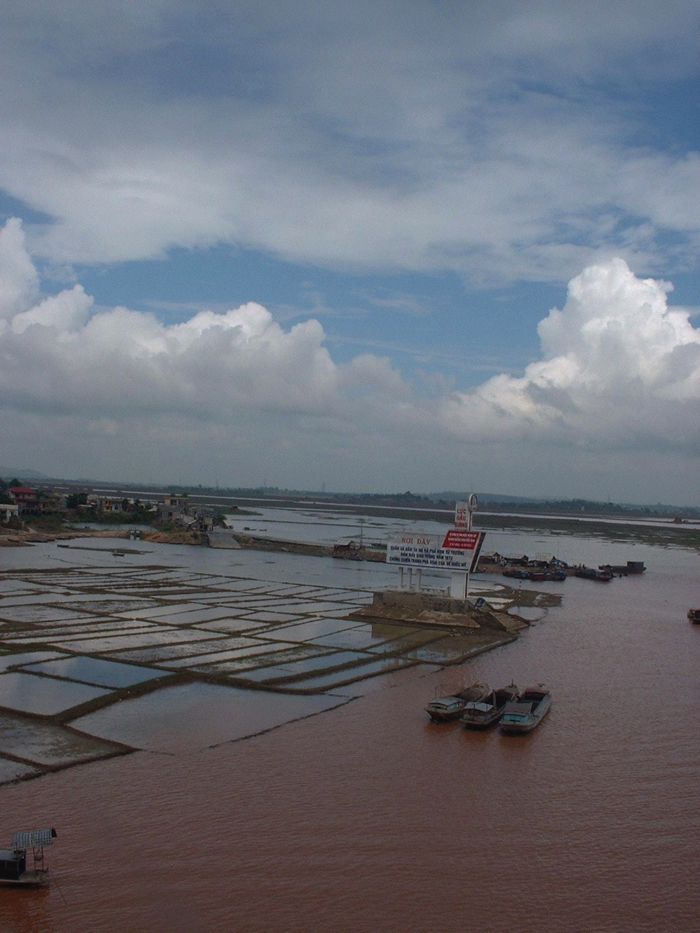 Duong River in the rainy season |
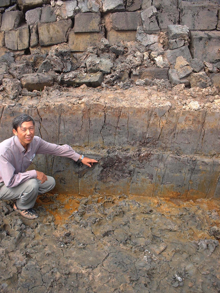 Wood fragments in silt layer in a back swamp area along the Duong River |