- Project Leader : Koizumi Yusuke (The University of Tokyo, Graduate School of Arts and Sciences)
Outline of Research
The development of oil palm plantations is dramatically expanding in Indonesia, especially in Sumatra island. On the one hand, NGO’s reports criticize the abuse of human rights in plantations or the destruction of environment because of the rapid clearing of forests. On the other hand, the number of smallholders who cultivate oil palm in a small scale is also increasing. The rural life in villages has been changing because the oil palm is a highly profitable commodity for the people in rural society too. This study will focus on the land-use change both of companies’ plantations and smallholders’ cultivation plots through the analysis of topographical maps stored in the CSEAS’s collections.
Description
In Riau province, which is located in the middle of Sumatra, not only companies’ plantations but also smallholders’ oil palm cultivation plots are expanding in Indonesia. This study will focus on the northern part of Riau province a lot of Batak people from North Sumatra province have immigrated and started cultivating oil palm. I will use topographical maps of the region and analyze them with the changes of livelihoods, the dynamics of population and the pattern of the creation of new villages through Geographical Information Systems.
Previous studies that focus on the land use change in Southeast Asian countries are mostly based on the analysis of remote-sensing. In contrast, we will use topographical maps instead, so that this study can analyze the space of everyday life in rural society by pointing out the accumulation of houses, the location of religious places or the network of local roads. The analysis of topographical maps through GIS might be a new approach towards better understanding of the rural societies in Indonesia.
The expected outcomes of this study are as follows. First of all, I will explain the changes of livelihoods around companies’ plantations in the north part of Riau province by comparing the topographical maps of 1980’s and 2000’s. Secondly, I will try to identify the migration pattern from North Sumatra province using topographical maps and population census implemented in 2000.
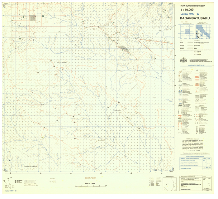 Topographical map (50,000:1) of Riau province in 1980’s. |
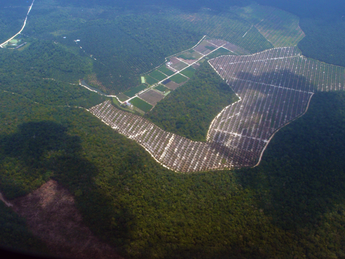 Rapid expansion of oil palm plantation in Riau province. |