- Project Leader : Hosobuchi Michiko (Kyoto University, Center for Southeast Asia Studies)
- Collaborators : Kozan Osamu (Kyoto University, Center for Southeast Asia Studies)
- : Almasdi Syahza (Riau University, Institute for Research and Community Services)
- : Edi Junaedi (Statistics Indonesia, Deputy Distribution and Service Statistics)
- : Surya Saluang (Satukata Institute)
Outline of Research
A community-driven peatland use model is needed for the protection and utilization of tropical peat degraded lands because these lands must be sustainably cared for to avoid fire and flood risks. To provide viable solutions for this situation, this study analyzes the “people” and “land” in the tropical peat degraded lands in Riau, Central Kalimantan, and Papua, Indonesia. The analysis delves into the historical, social, economic, legal, and governance perspectives surrounding the locals and how they care for these endangered lands. It uses a model case consisting of a community-based organization for sustainable peatland management and a system to support it, as well as a partnership to monitor and utilize the data for peatland use by locals and a system to manage it.
Description
The total area of tropical peatlands in Indonesia covers about 22.5 million hectares and has 30% of the world’s carbon resources. Research on tropical peatlands has been continuously conducted on soil, agriculture, water use, and landscape. By the 1990s, the development of peat swamp forests in South Sumatra, Jambi, Riau, and Central Kalimantan, among others, attracted attention to biodiversity loss and fire risk. The 2012 fires have brought renewed attention to the problems of low productivity, siltation of peat swamps, and soil degradation due to high acidity, making tropical peatlands not only an issue for peat communities, but also for environmental protection on a global scale.
In response to this global interest, local governments are aiming to exploit the “new resource” of peatlands as they pursue their own path of strengthening and managing autonomy not only at the provincial level, but also at the county level. Reflecting on the large-scale development, the aim is to use peatlands not only for industrial purposes, but also in an environmentally friendly way that is close to the residents’ lives, using appropriate technologies. Specifically, the carbon content of peatlands has been evaluated using satellite data; hydrological water quality observations using rainfall, water level, and flow data; and analysis of topography, vegetation, soil, and land use data (analysis of tree height, canopy diameter, and forest accumulation, adjustment of soil moisture content in peatlands, and analysis of hot spots) using satellite. In addition, it also aims to develop indicators for the appropriate use of land, and to return the results of these studies to the communities for communityled peatland management in a local context. Based on these indicators, community-driven peatland management in a way that is relevant to the local context is the goal.
However, at this stage, most of the people involved in these projects are engineers, and in many cases, the residents are not present at the time of these projects. Similarly, the more the projects focus on organizing the locals, the more the temporary organization becomes noticeable, mainly due to economic incentives. Finally, this has culminated in peatlands being viewed as “objects of development,” thus instigating apathy among the locals. In communities that have become project-driven, policy decisions have been made in a transitory manner, causing regions to be caught between central and local governance. There is also a growing movement within localities to return policy decisions that had originally been left to the state, the cities, and provinces themselves. As a result, residents are not able to plan for long-term programs, making them more vulnerable at times.
In response to these realities, this study aims to conduct experiments focusing on the cultivation of wetlands and reforestation, effective use of precipitation and water resources using hydro-meteorological data, and the establishment of an organization for community-driven hotspot analysis and fire management methods. Thereafter, it will present a proposal for appropriate management systems and partnership for community-driven peatland use, as well as a model case of monitoring and data utilization. This will play a crucial role in facilitating community-driven regional development policies for peat degraded lands.
This study specifically focuses on the Riau, Central Kalimantan, and Papua areas, which were identified as the highest priority areas by the Peatland Restoration Agency for the priod from 2016 to 2019.
 People’s Daily Lives in Tropical Peatland Societies (Riau Province) |
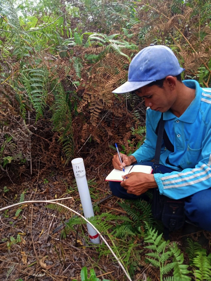 Environmental Monitoring of Peatlands by Local People (Riau Province) |