- Project Leader : Marui Masako (Sophia University, Faculty of Global Studies)
- Collaborators : Kobayashi Satoru (Kyoto University, Center for Southeast Asian Studies)
- : Kosaka Yasuyuki (Kyoto University, Graduate School of Asian and African Area Studies)
- : Im Sokrithy (APSARA National Authority, Angkor Training Center)
Outline of Research
At the end of the 20th century, “landscape” was added as one of the universal values of cultural heritage. “Landscape” in this context is composed not only of tangible properties, but also includes of surrounding villages. This new concept has became another global standard on a par with the conventional standard of cultural heritage conservation. The introduction of “landscape” (with villages) was caused by the inscription of Angkor on the world heritage list in 1992. The research project considers the various difficulties that local communities have faced during the ensuing 25 years, focusing on Angkor and the local knowledge that has been passed down over several generations. On the assumption that knowledge defines the direction that safeguarding heritage will take in the next generation, this project calls for a reconsideration of the historical development of the relationships of communities to their land and the environment by using informatics analysis.
Description
Since the beginning of the 21st century, the Cambodian government has pushed large-scale land development projects in the Angkor area. Most projects are carried out under the slogan of “rehabilitation of the landscape to one of the Angkor period.” However, no consensus with the local community has been built. Most villagers in this area live by producing wet-rice and by utilizing plant resources, and are therefore impacted by the projects.
Based on the above, our research group expresses doubts regarding the social justice and fairness in the process of landscape rehabilitation. The purposes of this joint international and interdisciplinary research are:
1. To create a mosaic of aerial photographs of the Angkor area for a re- vival of spatial information
2. To collect memories and experieces of villagers and archives that describe the relationships between local communities and surrounding environments.
The significance of the research is to unearth and gather spatial and local knowledge key to solving various problems that local communities are facing due to landscape and heritage conservation.
Through the studies, a new effective method will be developed to build sustainable and mutually-beneficial relations between cultural heritage efforts and community life. Furthermore, after reconsidering the social justice and fairness aspects of landscape rehabilitation, the research project will be able to connect administrative and community actors to build a platform for their future visions.
During the first year, through general survey in the three regions of the Angkor area (the Upper plain, the Central plain, and the Flood plain), our team collected information about livelihoods. This was compared with data previously collected by the project leader and a cooperating Cambodian researcher in the same villages. During the 2nd year, the project plans to 1) collate all the data, 2) translate Khmer statistical data to English, 3) interview people in the above mentioned three regions, and 4) compile cartographic data, aerial photographs, and village data in GIS.
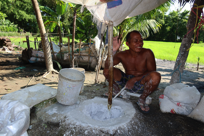 A home industry of mortar made from freshwater shells for conservation monuments |
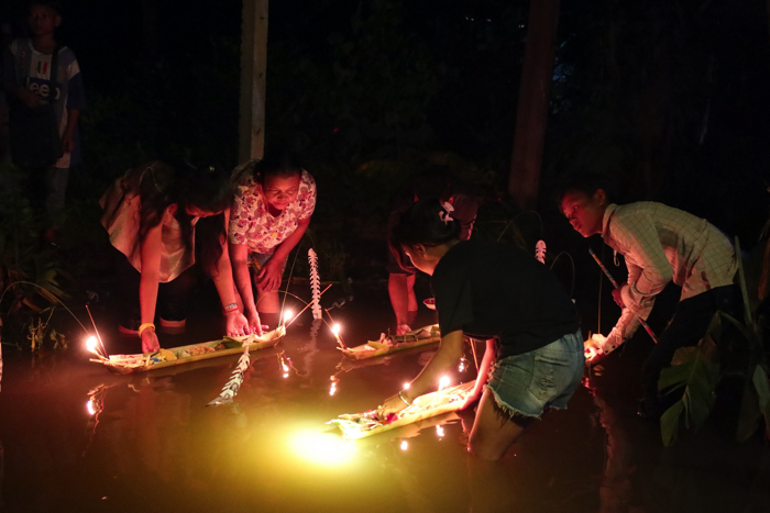 Boats made of banana-trunk floated down a rive at the end of Ullamabana |